Bike from the airport
Why bike from the airport?
Because it is fun. Because you’ve been sitting for several hours and need exercise. Because taxis from airports to downtowns are expensive. Because you get to see the city you are visiting from a different perspective.
It isn’t hard and it is quite safe. Cities have invested a lot in bike routes, but most visitors don’t use them. Most people don’t think to try biking or think business and biking don’t mix. They do, and we’d be a healthier country if they did more often.
How do I do this?
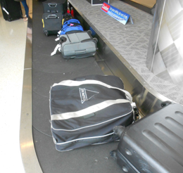
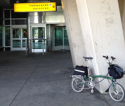
Get a folding bike that you can check as luggage. It needs to be 62 inches around to qualify. The smallest is the Brompton, which is the reason I bought one. You may have to pay to check a bag, or you may have airline status with free bag check as a benefit, which I do with Alaska. You fold your bike, put it in the canvas bag, and check it. When you arrive, you open the bag, unfold your bike, and roll up the canvas bag and sling it over your shoulder with the strap. Get a Victoronix slip case for your jacket and other dress clothes. I use the large briefcase that securely attaches to the front of the Brompton for my laptop, U lock and clothes. I also have a rear rack back that I can use if I don’t take a suit.
To find routes, use Google Maps and the bike button. I’ve added some additional comments below.
La Guardia to Manhattan
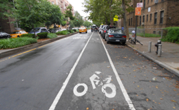
Those who tell you that you are nuts to bike from La Guardia to Manhattan probably haven’t done it. It is easy, safe and beautiful. Check Google Maps for the route, but basically you leave the airport on 94th St, connect with the 34th Street bike lane and follow the signed route to the Queensboro Bridge. It is very biker-friendly sometimes with 2 bike lanes and a painted line down the middle. You arrive in Manhattan and connect with the best bike network I’ve seen in the United States. Download the NYC Bike Map app for your iPhone before you go. Click here for more information.
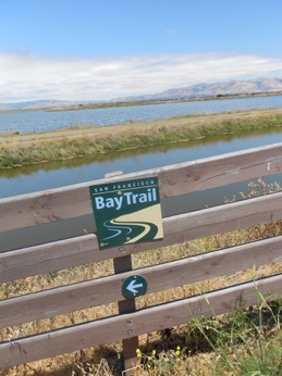
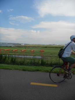
San Jose (Mineta) to Stanford
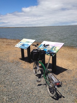
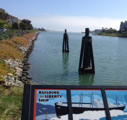
This is a gorgeous route, starting just to the east of the arrivals terminal where there is a paved/gravel path along the Guadalupe River Trail which is clearly visible on Google Maps. Follow the Trail until the Southbay Freeway when it connects with the Baylands Park Trail. Google should get this route right, and it does, because it continues along the Bay near the Googleplex. You will connect with the SF Bay Trail with views of shorebirds and marshland. You connect with the Moffett Field Bay Trail. Just before the Palo Alto Baylands Park, join the trail along the Bayshore, then cross 101 on the bike/pedestrian bridge into Palo Alto. Absolutely gorgeous. Be sure to put on lots of suncream.
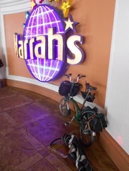
Las Vegas International to Las Vegas
You will likely be the only one biking from the airport, but since it is so close from the airport to the Strip and other hotels, why not? You’ve been sitting on a plane for several hours so it’s time to exercise. The trick on this one is getting out of the airport. Use Wayne Newton Boulevard but stay to the right and wait for gaps in traffic. Once you are out of the airport it isn’t bad. Keep biking and enjoy pulling up to your hotel on a bike. I haven’t tried valet parking--let me know if it works! (I put my Brompton back in it’s bag and take it up to my room.)
Portland International to Portland
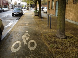
Portland has one of the best light rail systems connecting its airport with downtown, so why bike? Because it also has one of the best bike systems in the US which you miss on MAX. The bike routes take you through gorgeous neighborhoods (Irvington for example) that you might othewise not see. Revel at how nice Portland is to bikers. It’s the only place I’ve seen separate sidewalks for bikers, as well as separate lanes. There are many ways to get from the airport to Portland by bike. I prefer using residential bike lanes but you can also I 205 bike path. Once you are in Portland, bikes don’t rule but are close to par with cars in some areas. A pleasure.
Washington, DC National Airport
The Mt Vernon trail has a spur right in to National Airport, winding its way past the north end of the main runways and along the Potomac. Find it in the north end of the parking garage. If you take the northernmost walkway from the airport, as though you are going to Metro but keep going past Metro, then take the elevator to the bottom you’ll see a sign guiding you to the Mt. Vernon Trail. Once on the trail, you can stay on the Arlington side or cross the Potomac into the District on the 14th Street Bridge or Arlington Memorial Bridge. There is an extensive bike network, including the Capitol Crescent Trail which takes you to Bethesda. This is one of my favorite airports for bike connections. In 2014 we biked the entire C&O canal!
Minneapolis
If you are considering biking straight from the airport, read this. Because my bike was misplaced on arrival, I biked to the airport rather than in both directions. There are several routes available because of Minneapolis’ great bike infrastructure, but a beautiful, safe route is to use the West River Parkway. Since you have to take the light rail from the airport for at least one stop, I suggest taking it 3 stops and getting off at the 50th St/Minnehaha station. It is easier to find the entrance to the Parkway from there than from Fort Snelling. Once on the West River Parkway, you keep the Mississippi on your right until you are in the center of town, in Mill City, or you can branch off on the Midtown Greenway which is a superb separated bike route.
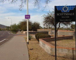
Phoenix
To avoid airport ‘freeways,’ take the free Skytrain to the 44th Street Station. Once you are away from the airport itself, there are lots of biking options. My destination was Scottsdale, about 10 miles away. There is a network of bike paths and canal paths that together are a beautiful introduction to the Phoenix area. On Google maps you can find the route: Start at E Washington & 44th, then east on Washington, left on Desert, then connect with the N Galvin bike path leading to the Desert Botanical Garden. (If you have time, the Garden is absolutely worth a visit.) From the Garden, head north across E McDowell, and within 1/8 mile you’ll see a small trail to the right. Take it to the 66th Street Canal path then head north to the Arizona Canal path which takes you to Scottsdale. Be alert on city streets: drivers don’t seem to expect you. And bring or buy sunscreen!
San Diego
I arrived at midnight so took a taxi to my destination (Paradise Point on Mission Bay). But on a sunny, cool Sunday afternoon I biked back to the airport linking bike paths shown on Google Maps, but not using the route recommended by Google Maps, which might be faster but involved freeway-like sections rather than safer paths parallel to the busier routes. I linked Ingraham Street, Sunset Cliffs, Nimitz and finally North Harbor Boulevards. Another tip is to enter and exit the airport via Airport Terminal Road which connects through large parking lots to the pedestrian overpasses from Terminals 1 and 2. It took 45 minutes by bike from Paradise Point to the Alaska Airline check-in counter, including stops for pictures and route finding. San Diego has great PDF maps of bike routes throughout the area available here. San Diego Airport has a great website with tips on walking/biking to the airport available here.
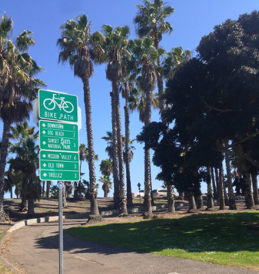
San Francisco
Riding from SFO to San Francisco is incredibly fun because you see beautiful, historic, and hidden bays and creeks mixed with industry and geography. And of course the weather is usually cool for cycling. The first trick is locating Courtyard G at SFO. I asked 3 times for directions, but once there the route out is just as Google Maps shows. Next trick: find the bridge over Colma Creek, the first natural wonder. You’ll use sections of the SF Bay Trail, the most beautiful of which is Oyster Bay. Then wind north to the only hill at Mile 9.5 and a long 3rd Street run until a great bike trail takes you across Islais Creek near the Team Oracle racing yacht storage. Folllow Illinois to Mariposa then 7th St/5th St into the City. Stop at a food cart for lunch. About 16 miles and better than BART because you are biking!
What about Seattle?
It’s best to take light rail downtown and connect with bike connections all over town. There is a bikeable route but I haven’t used it since light rail opened.
Last updated 4/12/14
Comments suggestions to thpayne@me.com
Airports covered
La guardia The best and most fun
Portland Great light rail but see neighborhoods
San jose The most beautiful
Las Vegas Easy, short, uncommon
Washington DC From National, a breeze
MINNEAPOLIS Along the Mississippi
PHOENIX Link canal trails and bike paths
San Diego Trails link salt water bridges
San Francisco The Bay, history, views