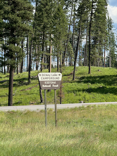
Day 13. North Dickey Lake Campground
47 miles 2,743 feet
Around Lake Koocanusa and down the Stillwater River valley toward Whitefish. I stopped in a USFS campground since the nearby lodge was full. Today was a lot of up and down on the shore of the lake, and then through a beautiful valley with small Montana towns. One of the highlights was a Filipino food cart in Eureka MT, a town of about 1,000 people. It was good too! I sat at a picnic table in the shade eating lunch and answering voicemail for retirement-related financial stuff. A note to those pondering retirement: there is a lot of this! Forms, PDFs signing, "we didn't see it but now we found it—sorry" sort of stuff. And all this is harder with sketchy cell coverage using a phone. But I got it taken care of.
The original plan was to meet Amy in Columbia Falls near the Kalispell airport but timing didn't work out so I've switched my focus to Going-to-the-Sun Highway and Logan Pass. Turns out the pass is still seasonally closed to cars and also to bikes except weekends or weekdays before 8 and after 4 pm. So I have a window: Sunday! I've made a reservation in a hotel in West Glacier which is over 70 miles a way for tomorrow night, and then Sunday I have 'only' 36 miles to Logan Pass! That is the last of the western passes—the sixth for those counting. It's also the highest but from a higher starting altitude. This map makes it clearer. In addition to being a beautiful ride without traffic it will also mean a transition to a new phase of my trip, passing the highest altitude (6,646 feet).
My impressions of Montana thus far: Gorgeous landscapes, lots of pickup trucks and lots of American flags. They are everywhere, even on the signpost for my campsite. I'm reading this as pride in our wonderful country rather than a political statement, though I'm sure sometimes these are confounded.
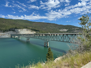
Lake Koocanusa Bridge
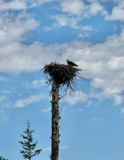
Lots of ospreys and eagles along the lake.
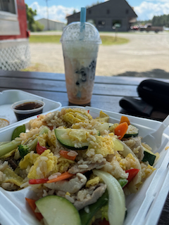
Filipino food truck lunch in Eureka. Eureka!
I overlapped briefly with a biker from the UK on the Great Divide Mountain Bike route. He's heading south
