Day 29. Little Yellowstone Campground
96 miles 1,693 feet
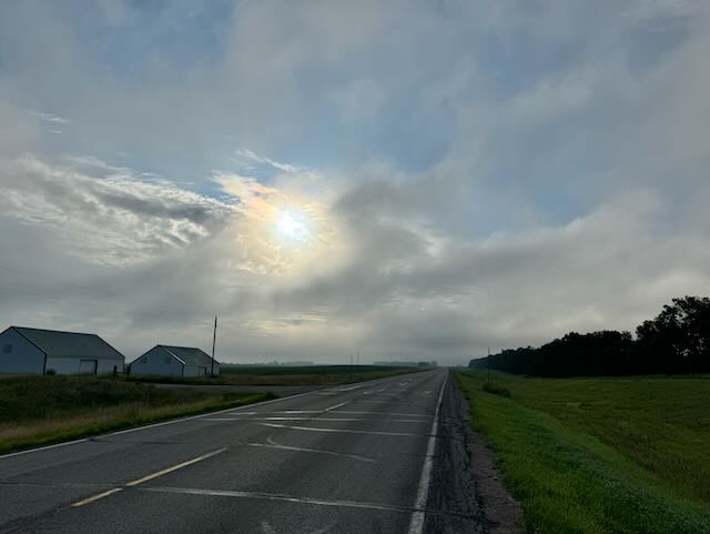
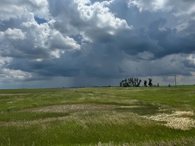
After finding no open breakfast source in Napoleon I had a cup of motel room coffee and took off east. It was a beautiful morning, with low clouds giving it a somewhat mysterious feel. I could see the road but nearby hills were shrouded and the sun poked through occasionally. It wasn't that hilly so I made good time. Eastern North Dakota becomes progressively flatter and that makes biking easier. Winds were mixed between tail and headwinds. Other than for an hour or so with fairly strong headwinds when the route turned north, wind wasn't much of a factor either way today.
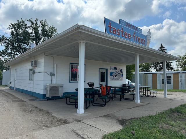
I made it 30 miles to Grackle for lunch (and breakfast) but only one place was open: Tastee Freez. But that was enough. Lots of locals were there and the chicken was highly recommended. No store was open in any town all day so I had a sandwich and a chicken breast to carry me till dinner.
At the Tastee Freez was a gentleman in his 80s with his dog. We were both sitting at picnic tables outside so I asked him about himself. He's lived his whole life within a few miles of Grackle and loves that people help each other and that there aren't too many people. He was a sheep farmer with his wife, who passed away 6 years ago, leaving him lonely. He lives in a nearby assisted living facility but they allow him to return to stay at his farm, where he is always welcome, and for days at a time. They pack up his meds for him. He enjoys Tastee Freez too!
There is a bike barn in Grackle, which is sort of famous in Northern Tier circles but since I'd just had a motel last night I didn't need the shower and Tastee Freez and a packed freeze-dried dinner met my food needs, so I didn't visit the barn.
Between Napoleon and 75 miles east is indicated on my ACA map as a Limited Services area and I found o open store or motel within it. I did find a listed state campground which was 94 mies from Napoleon so that was my only reasonable place to stay, though that distance is a reach. And here I am! I have it to myself. It's a pleasant spot so named because it is on the Sheyenne River and reminded someone of the Yellowstone River I suppose.
An interesting geographical feature was that just before descending to the small valley where my campground is there was a sign announcing the Continental Divide at about 1420 feet. I think this is the dividing line between the Missouri River drainage which empties into the Mississippi and the Red River which drains into Hudson's Bay. I'll have to research this when I'm back in a region with better cell service.
With these Limited Services areas one has to plan out where tasty and to buy food. I am now within easy range of Fargo, 75 miles to the east so this campground and Grackle's Tastee Freez was all I needed.
Tomorrow will be my last day in North Dakota. I marvel at my luck with the weather. Thunderstorms have largely missed me and the weather has been cool and nice.
(Posting this a day late because limited cell reception last night.)
After finding no open breakfast source in Napoleon I had a cup of motel room coffee and took off east. It was a beautiful morning, with low clouds giving it a somewhat mysterious feel. I could see the road but nearby hills were shrouded and the sun poked through occasionally. It wasn't that hilly so I made good time. Eastern North Dakota becomes progressively flatter and that makes biking easier. Winds were mixed between tail and headwinds. Other than for an hour or so with fairly strong headwinds when the route turned north, wind wasn't much of a factor either way today.
I made it 30 miles to Grackle for lunch (and breakfast) but only one place was open: Tastee Freez. But that was enough. Lots of locals were there and the chicken was highly recommended. No store was open in any town all day so I had a sandwich and a chicken breast to carry me till dinner.
At the Tastee Freez was a gentleman in his 80s with his dog. We were both sitting at picnic tables outside so I asked him about himself. He's lived his whole life within a few miles of Grackle and loves that people help each other and that there aren't too many people. He was a sheep farmer with his wife, who passed away 6 years ago, leaving him lonely. He lives in a nearby assisted living facility but they allow him to return to stay at his farm, where he is always welcome, and for days at a time. They pack up his meds for him. He enjoys Tastee Freez too!
There is a bike barn in Grackle, which is sort of famous in Northern Tier circles but since I'd just had a motel last night I didn't need the shower and Tastee Freez and a packed freeze-dried dinner met my food needs, so I didn't visit the barn.
Between Napoleon and 75 miles east is indicated on my ACA map as a Limited Services area and I found o open store or motel within it. I did find a listed state campground which was 94 mies from Napoleon so that was my only reasonable place to stay, though that distance is a reach. And here I am! I have it to myself. It's a pleasant spot so named because it is on the Sheyenne River and reminded someone of the Yellowstone River I suppose.
An interesting geographical feature was that just before descending to the small valley where my campground is there was a sign announcing the Continental Divide at about 1420 feet. I think this is the dividing line between the Missouri River drainage which empties into the Mississippi and the Red River which drains into Hudson's Bay. I'll have to research this when I'm back in a region with better cell service.
With these Limited Services areas one has to plan out where tasty and to buy food. I am now within easy range of Fargo, 75 miles to the east so this campground and Grackle's Tastee Freez was all I needed.
Tomorrow will be my last day in North Dakota. I marvel at my luck with the weather. Thunderstorms have largely missed me and the weather has been cool and nice.
(Posting this a day late because limited cell reception last night.)
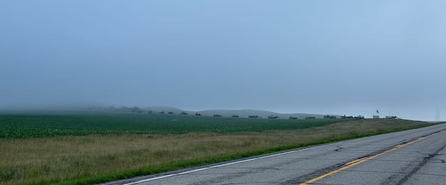
Looks like a procession of military vehicles in the misty distance
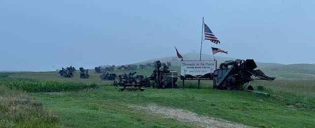
Actually it's museum of harvesting equipment
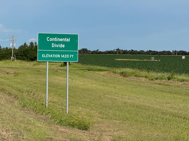
One side drains to the Missouri and the other to Hudson's Bay via Red River of the North
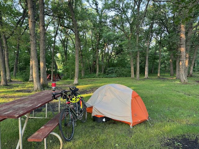
Little Yellowstone campground on the Sheyenne River
